Every day, hundreds of eyes in the sky are quietly observing Earth. From high above, satellites track hurricanes forming in the ocean, measure the dwindling ice at the poles, and even count crops growing in fields. This complete guide breaks down how this space-based monitoring works, its evolution over time, and why it matters. We’ll explore the major ways satellite Earth observation is used – from environmental protection and climate change tracking to agriculture, disaster response, urban planning, and national security – and highlight the key players (NASA, ESA, NOAA, ISRO, and private companies like Planet Labs). We’ll also cover the latest developments (new satellites launched, cutting-edge tech like AI onboard, and policy debates as of 2024–2025) to show how space technology is watching our planet right now.
What Is Satellite Earth Monitoring?
Satellite Earth monitoring (also known as Earth observation or remote sensing) means using satellites orbiting our planet to collect information about Earth’s surface, oceans, and atmosphere en.wikipedia.org. Instead of observing stars or other planets, these satellites are pointed back at Earth. They carry cameras and scientific sensors that take images or measurements of Earth on a regular basis. In simple terms, they are like orbiting weather stations and cameras that give us a continuous, global “eye in the sky.”
Unlike a photograph from an airplane, satellites can cover the whole globe and revisit the same areas frequently. Some capture pictures in visible light (much like a digital camera), while others use infrared sensors to measure heat, radar to map the surface (even through clouds or at night), or other instruments to detect things like atmospheric gases. All this data is beamed down to Earth, where it’s used by scientists, governments, businesses, and even the public (for example, through maps and apps). In short, satellite monitoring turns raw images and signals into vital information – whether it’s spotting a brewing storm, measuring pollution, or checking how last year’s crops grew.
Why monitor Earth from space? Because the view from orbit provides a big-picture perspective impossible to get from the ground. Satellites can see entire weather systems at once, observe remote regions regularly, and track changes over years and decades. They are essential for understanding global phenomena like climate change, and for responding quickly to events like natural disasters. As one science writer put it, “Getting a bird’s-eye view of our planet is key to understanding it.” space.com. With more Earth-observing satellites in orbit now than ever before, our ability to watch over the planet has become truly unprecedented space.com.
A Brief History of Watching Earth from Space
Satellite Earth observation has evolved from a daring idea to an everyday reality over the past six decades. Here are some key milestones in its history:
- The Early Experiments (1950s–1960s): The very first satellites were not launched to study Earth – but they unintentionally did. In 1957, the Soviet satellite Sputnik 1 sent back radio signals that scientists analyzed to study Earth’s upper atmosphere en.wikipedia.org. The U.S. followed with Explorer 1 in 1958, which carried a detector that discovered Earth’s radiation belts en.wikipedia.org. These proved we could gather scientific data from orbit. In April 1960, NASA launched TIROS-1, the world’s first weather satellite, which sent back the first TV images of Earth’s cloud cover en.wikipedia.org. TIROS-1 operated only 78 days but demonstrated the huge value of monitoring weather from space nasa.gov. By 1964, NASA’s Nimbus satellites were providing new insights into weather and the environment, including the first satellite images of hurricanes and even measurements of oceanic plant life and ozone nasa.gov.
- Cold War and Spy Satellites: At the same time, the Cold War drove rapid advancements in Earth observation for military reconnaissance. After a high-altitude spy plane was shot down in 1960, the U.S. accelerated secret satellite programs like CORONA to photograph military installations from space en.wikipedia.org. By the mid-1960s, satellites had largely replaced risky spy plane flights en.wikipedia.org. (Much of this early reconnaissance work remained classified for decades.) These early “eyes in the sky” proved the concept of high-resolution imaging from orbit and pushed camera technology forward, though their work was hidden from public view.
- Opening Eyes to Earth Resources (1970s–1980s): In July 1972, the U.S. launched Landsat-1 (originally called ERTS-1), the first satellite dedicated to mapping Earth’s land resources nasa.gov. This was a game changer. Landsat carried a multispectral scanner to systematically photograph Earth’s surface in color bands, helping map forests, crops, geologic features, and more. The Landsat program (still running today) has created an unparalleled 50+ year continuous record of Earth’s land cover changes. Early Landsat images stunned scientists – for example, revealing the full extent of global deforestation and changes in water bodies. By the 1980s, NASA and other agencies began treating Earth as an integrated system to be studied from space. NASA’s Earth Observing System concept emerged, leading to missions that monitor land, oceans, atmosphere and ice together over the long term nasa.gov.
- Weather and Climate Monitoring Grows: Starting in the 1970s, meteorological agencies launched improved weather satellites. NOAA’s GOES series (Geostationary Operational Environmental Satellites) began in 1975 and has provided constant watch over the Americas for decades nasa.gov. Polar-orbiting weather satellites also expanded (NASA/NOAA’s POES series, Europe’s Meteosats, etc.), giving global coverage. By continuously observing Earth’s weather, these satellites built a 50-year climate record. “By continuing to watch geostationary satellites, we’re now getting to the point where we can have a very robust, nearly 50-year look at how the atmosphere is changing,” noted one NOAA scientist space.com. In the late 1980s, satellites also discovered the Antarctic ozone hole (with NASA’s Nimbus-7 and NOAA’s satellites confirming the continent-wide ozone depletion) nasa.gov, spurring international action to ban CFCs.
- Boom of Earth Observing Missions (1990s–2000s): Satellites became central to environmental science. NASA launched specialized missions like TOPEX/Poseidon (1992, to measure sea level), SeaStar/SeaWiFS (1997, ocean color), Terra and Aqua (1999/2002, flagship platforms carrying multiple instruments to study Earth’s climate system), GRACE (2002, twin satellites measuring Earth’s gravity to track water movement) nasa.gov, and ICESat (2003, laser altimeter to measure ice sheet changes) nasa.gov. Europe launched its own missions: e.g., ESA’s ERS-1/2 radar satellites in the 1990s, Envisat in 2002 (a large satellite observing atmosphere, ocean, and land), and SPOT series from France for high-res land imaging. These missions vastly expanded the data available on everything from global temperature trends to rainforest loss. By 2008, there were over 150 active Earth observation satellites in orbit, together gathering more than 10 terabits of data each day en.wikipedia.org – a volume that would only explode in the coming years.
- The New Space Era (2010s–Present): In recent years, Earth monitoring has entered a golden age of both government and commercial satellites. Advances in technology made satellites smaller and cheaper, enabling private companies to build fleets of them. By 2021, over 950 Earth observation satellites were in orbit (an astonishing growth from just 150 in 2008) en.wikipedia.org. Notably, a private company – Planet Labs – operated the largest number of them, eclipsing any single nation’s fleet en.wikipedia.org. Planet and others pioneered tiny CubeSats that photograph the Earth daily, meaning near real-time imagery of the whole planet became a reality. At the same time, government programs have continued to launch more powerful satellites with advanced sensors (for example, NASA/NOAA’s latest GOES-R weather satellites, ESA’s Copernicus Sentinel series, and China’s Gaofen series). Today, an “armada” of satellites monitors Earth continuously – tracking everything from minute air pollution changes to the growth of megacities – ushering in what some call a “Golden Age” of Earth observation space.com. The challenge now is no longer getting the data, but managing and analyzing the flood of information coming from space.
How Satellites Monitor the Earth
To understand how space technology keeps an eye on our planet, let’s look at how these satellites work – in terms of where they orbit and what kind of sensors they use.
- Orbits and Coverage: Most Earth observation satellites fly in low Earth orbit (LEO) a few hundred kilometers above the ground. At ~500–800 km altitude, they circle the Earth in about 90-100 minutes en.wikipedia.org. Many use a polar, sun-synchronous orbit – meaning they travel over the poles and cross the equator at the same local time each day en.wikipedia.org. This lets them scan a different slice of Earth with each orbit as the planet rotates beneath, eventually imaging the entire globe. For example, a satellite in sun-synchronous orbit might pass over your city every day at about 10:30 am local time, ensuring consistent lighting for comparisons. These low orbits allow relatively high resolution imaging (seeing smaller details) and are ideal for mapping and monitoring applications. By contrast, geostationary satellites sit much higher (about 36,000 km up) and match Earth’s rotation, effectively “hovering” over the same spot (typically over the equator) en.wikipedia.org. A single geostationary satellite can constantly view an entire hemisphere of Earth. This makes them perfect for continuous weather monitoring, since they can watch cloud movements, storms, and other developments in real time over a huge area. (For instance, only three well-placed geostationary satellites are needed to cover most of the globe en.wikipedia.org.) However, being so far away means their images have lower resolution. In summary, low-orbit satellites give detailed snapshots of Earth piece by piece, while geostationary satellites give a full-disk movie of Earth’s weather, updated every few minutes.
- Types of Sensors: Earth observation satellites can “see” in different ways:
- Optical Imagers: These are essentially space cameras that capture reflected sunlight (visible and infrared light) from Earth. The images look much like photographs or color maps. Optical sensors are great for capturing land cover, vegetation health, water color, and even city lights at night en.wikipedia.org. Most people are familiar with optical satellite imagery via maps (e.g., Google Earth) or news photos from space. The resolution can vary – some satellites see wide areas in moderate detail (e.g., 10–30 meter resolution, like Landsat), while others zoom in to sub-meter resolution (commercial satellites can resolve cars or even smaller objects). Optical imaging is limited by daylight and weather; they can’t see through clouds and only work when the area is sunlit.
- Radar and Microwave (Active Sensors): These satellites carry radars that actively send microwave pulses toward Earth and measure the signals that bounce back. This is known as Synthetic Aperture Radar (SAR) imaging. Radar can penetrate clouds and even observe at night, providing all-weather, day/night coverage. Radar images look different from photos – they show structures and surface texture (and are very useful for detecting changes like ground deformation, ice movements, or oil spills on water) en.wikipedia.org. For example, Europe’s Sentinel-1 SAR satellites can monitor floods or deforestation even under cloud cover, and ESA’s Envisat used radar to track a 2002 oil spill off Spain en.wikipedia.org. Other active sensors include lidar (laser ranging, used for measuring elevation like NASA’s ICESat measuring ice sheet thickness) and altimeters (radar altimeters measuring sea level).
- Thermal Infrared: Many satellites also have thermal infrared sensors to measure heat emission. These essentially take Earth’s temperature from space. They are vital for detecting wildfires (hotspots), monitoring volcanoes, measuring sea surface temperatures, and even urban heat islands. For example, NASA’s MODIS sensor routinely maps fires and the heat signature of cities.
- Multispectral and Hyperspectral Sensors: Instead of just three color bands (red, green, blue) like a normal camera, Earth satellites often capture many wavelengths of light, including invisible bands (ultraviolet, various infrared). Multispectral imagers (like Landsat’s) might have 7–10 bands; hyperspectral imagers (like the new NASA PACE mission) can have dozens, splitting light very finely. These allow scientists to detect subtle details – e.g., distinguishing between different crop types or phytoplankton species by their spectral “fingerprint” nasa.gov. The PACE satellite launched in 2024 can even identify types of microscopic plankton in the ocean from space by analyzing color gradients nasa.gov.
- Atmospheric Sensors: Some satellites carry instruments to specifically measure the atmosphere – for instance, spectrometers that scan for gases like carbon dioxide, ozone, or methane by looking at the spectrum of sunlight passing through the air. An example is NASA’s OCO-2 satellite that measures CO₂, or ESA’s Sentinel-5P which maps pollutants like nitrogen dioxide. Weather satellites also have sounders that measure temperature and humidity at different altitudes.
In practice, many satellites are “sensor suites” carrying multiple instruments. For example, a single satellite might have a camera, a radar, and a radiometer on board, to collect many types of data at once. As technology improves, satellites are becoming even more capable. A noteworthy trend is higher resolution and frequency: modern commercial satellites can resolve features about the size of a foot (30 cm) across, and small CubeSats in large numbers mean the same area can be imaged multiple times a day. This fine detail is incredibly useful, but it also raises privacy questions – since satellites might observe people or property without consent. Experts point out that as satellite surveillance expands, it “puts the world’s information in the hands of any company with a satellite,” posing potential privacy and security risks if not managed vce.usc.edu. Regulations today limit the maximum resolution of imagery that companies can sell (in the U.S., ~25–30 cm for commercial images pubs.acs.org), but the ethical debate continues as technology leaps forward.
Major Applications of Satellite Monitoring
Satellites are essentially tools, and their data can be applied in countless ways. Here we cover the major applications of Earth monitoring and how space-based observations are used in each area:
Environmental Monitoring and Conservation
One of the most important uses of satellite data is keeping tabs on Earth’s environment – tracking the health of our planet’s land, water, and ecosystems. Because satellites provide repetitive, standardized observations, scientists can detect environmental changes that might otherwise go unnoticed from the ground. Key aspects include:
- Forests and Land Use: Satellites like Landsat and Europe’s Sentinel-2 have long records of Earth’s land cover, allowing us to monitor deforestation, reforestation, and land use changes over time. For example, by comparing satellite images year after year, we can see the shrinking of the Amazon rainforest, expansion of agriculture, or urban sprawl. Changes in vegetation can also indicate drought conditions – if a normally green area turns brown in satellite indices, it signals stress. In fact, satellites routinely produce drought maps by comparing current plant health to long-term averages en.wikipedia.org. This helps governments plan for water shortages or crop failures.
- Wildlife Habitat and Biodiversity: Environmental agencies use satellite maps to identify critical habitats and how they’re changing. For instance, wetlands or coral reefs can be monitored for degradation. Even wildlife tracking is aided by satellites – e.g., tracking water levels in remote lakes that migratory birds rely on.
- Oceans and Water Quality: From space, we can measure ocean color, which tells us about phytoplankton (microscopic plants) in the water. This is key for understanding marine food webs and fisheries. Satellites can also detect harmful algal blooms or sediment plumes after floods. For example, a satellite image might show a green algae bloom in a Great Lakes region, warning officials of a water quality issue nasa.gov. Additionally, thermal sensors map sea surface temperatures worldwide, helping track phenomena like El Niño or marine heatwaves that can bleach corals. Coastal monitoring is another aspect – satellites help map coastlines, detect oil spills (radar is particularly good at spotting oil slicks on water en.wikipedia.org), and monitor water turbidity.
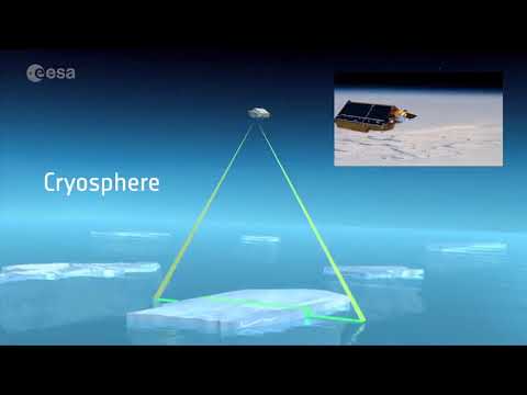
- Ice and Snow: In the cryosphere, satellites are crucial. They monitor the extent of Arctic sea ice year-round, as well as the changes in ice sheets on Greenland and Antarctica. Missions like ICESat and GRACE have measured whether ice sheets are gaining or losing mass (sadly, mostly losing) by the subtle changes in gravity or surface height nasa.gov. This informs projections of sea level rise. Snow cover is tracked by satellites too, since it’s important for water supply in many regions.
- Pollution and Air Quality: Special sensors (like those on NASA’s Terra/Aqua or ESA’s Sentinel-5P) can measure air pollutants (e.g., NO₂, SO₂) and even greenhouse gases across the globe. We can literally see pollution clouds from space over industrial areas or wildfire smoke spreading. This helps enforce environmental regulations and understand sources of emissions. For instance, satellites have monitored the recovery of the ozone layer after the 1987 Montreal Protocol – confirming that the ozone hole over Antarctica is slowly healing now that CFCs are banned nasa.gov.
Overall, Earth monitoring satellites act as an environmental alert system for the planet. They often provide the first indication of a problem – whether it’s illegal logging in a rainforest, a sudden algal bloom in a lake, or rapid melting of mountain glaciers. As one official put it, Copernicus (the European satellite network) has become “the backbone of Europe’s environmental data infrastructure,” delivering tens of terabytes of free data daily to scientists, businesses, and citizens, because “space is for everyone” space.com.
Tracking Climate Change
Satellites are absolutely critical in studying climate change, often described as humanity’s biggest challenge. They provide hard data on global-scale trends that would be impossible to gather otherwise. Key contributions include:
- Global Temperature and Weather Patterns: Weather satellite records over decades have shown clear trends in warming. Scientists combine data from many satellites (on surface temperatures, atmospheric temperatures, ocean heat content, etc.) to understand how the climate is changing. NASA’s analysis of satellite data has been instrumental in confirming that Earth’s average temperature has risen about 1.1°C (2°F) since the late 19th century and that humans are the main cause nasa.gov. Continuous satellite measurements also help refine climate models – e.g. observing how weather patterns like monsoons or jet streams are shifting.
- Ice and Sea Level Rise: As mentioned, satellites monitor ice extent and ice sheet mass. The findings are sobering – satellites have shown accelerating ice loss from Greenland and Antarctica. At the same time, radar altimeter satellites (like the joint NASA/CNES TOPEX/Poseidon and later Jason series, and the newest Sentinel-6 Michael Freilich launched in 2020) have measured sea level rise very precisely from the 1990s to today. The global sea level is rising (currently about 3.7 mm per year) due to melting ice and warming oceans, and satellites provide the definitive record of this trend.
- Greenhouse Gases: Newer satellites can “sniff” the concentration of CO₂ and methane in the atmosphere. NASA’s Orbiting Carbon Observatory-2 (2014) and its upcoming CO₂-tracking missions, as well as planned European missions in the Copernicus expansion, are aimed at monitoring greenhouse gas emissions from space. This could even help verify countries’ emissions cuts pledges. In 2024, ESA secured funding for next-gen Sentinel satellites that will track greenhouse gases and air quality more closely space.com.
- Earth’s Energy Budget: Climate change is fundamentally about energy imbalance (more energy trapped by greenhouse gases). Satellites like NASA’s CERES instrument measure how much solar radiation Earth reflects back vs. emits as heat, helping quantify this imbalance. Missions like EarthCARE (launched 2024 by ESA/JAXA) are studying clouds and aerosols to understand their role in climate. Clouds and tiny particles can either cool or warm the planet, and EarthCARE’s advanced lidar and radar aim to clarify these effects by profiling clouds and aerosols globally.
- Extreme Events and Impacts: Satellites also document the symptoms of climate change: more extreme weather, wildfires, droughts, etc. For example, the intensity and frequency of hurricanes can be monitored via ocean heat content measured by satellites. A stark example came in recent years with marine heatwaves – satellites detected record-high sea surface temperatures in parts of the oceans space.com, contributing to events like coral bleaching. Similarly, the progression of mega-droughts or the spread of wildfires in a hotter climate are tracked from above, providing evidence of climate impacts in real time.
In summary, without satellites, our understanding of climate change would be like trying to diagnose an illness without a thermometer or X-ray. As a Space.com analysis noted, Earth-monitoring satellites continue to prove critical in studying climate change space.com. They not only collect data to inform science (like inputs to IPCC reports, which draw on tens of thousands of satellite-based data points space.com), but also help policymakers by showing where action is needed. For example, satellites can highlight regions losing groundwater or facing crop failures due to shifting climate patterns, enabling early intervention.
Importantly, agencies worldwide recognize this. “Climate change is the defining challenge of our generation,” said Austria’s innovation minister in 2025, emphasizing that we must “transform observation into immediate action” space.com. The good news is we have more powerful tools than ever – the fleet of climate satellites now in orbit – to guide that action. Missions like NASA’s PACE (launched 2024) exemplify this by studying ocean ecosystems and aerosols to fill key knowledge gaps about global warming nasa.gov. As NASA Administrator Bill Nelson remarked during PACE’s launch, this satellite will “help us learn, like never before, how particles in our atmosphere and our oceans” influence global warming nasa.gov. Such knowledge is essential for tackling the climate crisis.
Agriculture and Food Security
Satellites have become the farmer’s new best friend (and a crucial tool for governments and organizations managing food security). They enable precision agriculture and monitoring of crops on regional to global scales:
- Crop Monitoring: During the growing season, satellites continuously observe crop regions. By measuring the greenness (via indices like NDVI from multispectral images), they can assess crop health, growth stage, and even estimate yields. Farmers and agronomists use this to spot issues like pest infestations, disease, or water stress in fields early – often before the human eye would notice. Governments use satellite data to forecast harvests and identify potential famine regions by seeing where crops are failing due to drought or other factors. For instance, organizations like the FAO and World Food Programme rely on satellite-driven early warning systems to trigger aid when they see poor rainfall and vegetation in key farming areas.
- Drought and Irrigation Management: Satellites help monitor soil moisture (some use microwave sensors for this) and reservoir levels. They also show how well-irrigated fields are (infrared imagery can indicate moisture content). This informs water management – e.g., if a region is entering a drought, satellites will show dropping reservoir extents and drying vegetation, prompting water-saving measures. Thermal images can even identify which parts of a large farm are moisture-stressed so farmers can adjust irrigation just in those areas, saving water.
- Land Use and Crop Area Mapping: Each year, countries want to know how much of each crop was planted (e.g., how many hectares of wheat versus corn). Traditionally done with ground surveys, this mapping is now often done with satellites – different crops have distinct spectral signatures and planting/harvest timings. This is important for commodity markets and food supply planning. The European Sentinel-2 satellites, for example, provide frequent high-resolution imagery that’s excellent for classifying crop types across Europe and beyond, feeding into the EU’s agricultural monitoring.
- Insurance and Disaster Recovery: Crop insurance companies use satellite data to validate claims (for example, confirming that a flood actually submerged the fields in question, or that yields were poor due to drought). After disasters like floods, satellites map the affected agricultural areas quickly so relief can be directed. The same goes for flood or storm damage to crops – a “before and after” image pair from space clearly shows the extent of destruction.
- Pasture and Livestock Management: In ranching regions, satellites are used to monitor pasture conditions and prevent overgrazing. They can indicate where forage is abundant or sparse, helping ranchers rotate herds.
In short, satellite monitoring enables a shift toward smart farming, where decisions are data-driven. It reduces guesswork – farmers can get alerts if any part of their field is underperforming, and agencies can respond faster to looming food shortages. This is increasingly vital as climate change introduces more variability in weather and crop outcomes. With the world’s population growing, such tools help maximize agricultural output sustainably. As one example of innovation, AI combined with satellite imagery now allows global crop type mapping (like ESA’s WorldCereal project) to produce near real-time crop maps – the FAO has praised these efforts as a milestone for operational global crop monitoring esa-worldcereal.org.
Disaster Response and Humanitarian Aid
When natural disasters strike, satellites are often the first to survey the scene, especially when the area is remote or infrastructure is down. They play a crucial role in emergency response and recovery by providing timely information:
- Weather Disasters: Weather satellites track hurricanes, cyclones, and typhoons from the moment they form. Meteorologists rely on geostationary satellite images to monitor a storm’s path and intensity hour by hour, enabling more accurate forecasts and evacuation warnings. For instance, NOAA’s GOES satellites continuously watched Hurricane Katrina approach and make landfall in 2005, providing imagery that helped forecasters anticipate its strengthening nasa.govnasa.gov. Today’s satellites are even more advanced – they can scan a hurricane in multiple wavelengths to reveal its structure and help predict rapid intensification. They also estimate rainfall and can trigger flood alerts. Beyond storms, satellites also detect severe weather like thunderstorms and tornado-forming supercells, giving short-term warning capability.
- Floods and Earthquakes: After a major flood, satellites (especially radar satellites that see through clouds) map exactly which areas are underwater. This is critical for directing rescue teams and resources. For example, if a hurricane causes river flooding over a huge region, a satellite map will show which roads are cut off and which towns are submerged. In earthquakes, satellites can quickly image affected cities to show collapsed buildings or infrastructure damage. Additionally, a technique called InSAR (interferometric SAR) can measure ground displacement from before-and-after radar data – used notably to map how the ground moved in earthquakes, which helps in understanding the quake and planning rebuilding in stable zones.
- Wildfires: Satellites with thermal sensors are excellent at detecting wildfires in remote areas. They spot the hot spots and even provide estimates of fire intensity and spread. Programs like NASA’s MODIS and VIIRS-based fire detection send alerts to firefighters worldwide. During a wildfire, satellites track the smoke plumes and air quality impacts, and high-resolution images help map the burn scar once the smoke clears. This guides containment and later rehabilitation (seeing where vegetation is completely destroyed, for example).
- Volcanic Eruptions: Remote volcanoes are monitored by satellites for signs of eruption (thermal increase, ground deformation, gas emissions). When an eruption occurs, satellites map the ash plume (which is vital for aviation safety – e.g., during the 2010 Eyjafjallajökull eruption, satellites tracked the ash cloud drifting over Europe en.wikipedia.org). They also show lava flows and ash fall areas, aiding local authorities.
- Humanitarian Crises: In conflict zones or refugee situations, satellite imagery often provides impartial, up-to-date information. For example, during conflicts, relief agencies use imagery to count how many buildings have been destroyed or how many tents are in a refugee camp, to gauge the scale of needs. In inaccessible areas, satellites might be the only way to understand what’s happening on the ground.
- Search and Rescue: Some satellites carry transponders for emergency beacons. For instance, satellites in the COSPAS-SARSAT system listen for distress signals from ships or hikers and relay their location to rescue teams. Also, after plane crashes or shipwrecks, Earth observation satellites have been tasked to help find debris or oil slicks.
A dramatic example of space-based disaster aid is the International Charter on Space and Major Disasters, an agreement through which space agencies worldwide provide free satellite imagery support during disasters. When activated (say, for a massive flood or an earthquake), numerous satellites will take images of the affected area and share them with rescue teams and local authorities in near-real-time. This has improved response times and situational awareness significantly in recent decades.
As NASA’s administrator Bill Nelson highlighted during the launch of NOAA’s latest GOES satellite, with extreme weather on the rise, “satellites like GOES-U keep a close watch to monitor weather in real time” and bring down critical data to prepare for severe storms nasa.gov. This continuous watch from above strengthens resilience by giving us more lead time and accurate information when nature turns dangerous nasa.gov. Additionally, Nicky Fox, a science mission leader at NASA, noted that GOES data has myriad uses that directly impact our daily lives – from tracking climate changes to providing critical warning information before natural disasters strike nasa.gov. In essence, satellite monitoring has become an indispensable part of the global disaster-response toolkit.
Urban Planning and Smart Cities
Cities might seem entirely “mapped out” by now, but satellites continue to assist urban planners and policymakers in managing growth and infrastructure. Urban planning applications include:
- Mapping Urban Expansion: Satellites regularly update maps of cities, showing how fast and in what direction they are growing. This helps city planners understand sprawl, land use changes (like farmland or forests turning into suburbs), and the need for expanding services. Historical satellite imagery can even be turned into time-lapse videos of a city’s expansion over decades – a powerful visualization for planners and the public alike.
- Infrastructure Monitoring: High-resolution images can reveal when new roads are built, buildings constructed, or illegal encroachments occur. Planners use this to ensure development follows regulations. For example, if unauthorized settlements appear in a floodplain, satellite evidence can prompt action before a disaster strikes. Some satellites can also detect subtle ground movements; this is useful for monitoring the stability of structures (like seeing if the land under a large dam or skyscraper is subsiding).
- Urban Heat Islands: Cities are often warmer than surrounding rural areas due to concrete and asphalt absorbing heat. Thermal satellite data helps map these urban heat islands in detail. City officials can identify which neighborhoods have the worst heat and potentially add green spaces or cool roofs. NOAA’s new generation weather satellites even have the resolution to look at community-level temperatures, allowing insights into heat disparities within a city space.com.
- Traffic and Mobility: While satellites are not the primary tool for real-time traffic (that’s more done via GPS and sensors), they provide data on infrastructure and can aid in planning transport networks. For instance, up-to-date imagery helps in planning new highways or public transit routes by showing current land use and space availability. There are also experimental uses of imaging to estimate traffic density or parking usage from space.
- Environmental Monitoring in Cities: Satellites help cities manage pollution – e.g., observing smog levels or tracking how a city’s air quality changes after policy interventions (like a lockdown or introduction of an emission zone). They can also assist in monitoring urban water bodies (checking for pollution or algal growth in reservoirs) and green cover (how much urban forest or park area exists and whether it’s changing).
- Disaster Planning: Urban areas are complex, and planning for disasters (floods, earthquakes) is aided by satellite data. Flood risk maps derived from satellite terrain data and historical flood imagery guide cities in developing drainage or avoiding construction in high-risk zones. After disasters, as noted, satellites map damage in cities which feeds back into rebuilding plans (making cities hopefully more resilient next time).
In summary, satellite Earth observation contributes to the “smart city” concept by providing regular, objective data on the urban environment. It complements ground surveys with a bird’s-eye (or rather, satellite’s-eye) view that can take in an entire metropolitan region at once. This helps ensure that planning is based on current reality, not outdated maps. As more high-res satellites come online, even mid-sized cities around the world can be monitored frequently, helping urban planners everywhere make informed decisions about sustainable development.
Defense and National Security
The origin of satellite monitoring was in defense, and it remains a key domain. Military and intelligence agencies worldwide use Earth observation for security purposes, both via their own classified satellites and increasingly through commercial imagery:
- Reconnaissance and Surveillance: High-resolution imaging satellites (often called spy satellites when used for military intel) can provide detailed photos of activities on the ground. They are used to monitor military buildups, movements of troops or equipment, missile launches, naval deployments, etc. For example, during the tensions leading up to recent conflicts, commercial satellites from companies like Maxar captured images of massed tanks and artillery, which were shared in the media. Governments use even higher-resolution classified satellites to monitor such developments in near real time. This capability acts as both an early warning system and a deterrent (since large-scale secret movements are now much harder to hide from the ever-watchful eyes in space).
- Treaty Verification: Satellite data is key to arms control treaties and verifying that countries adhere to agreements (like not testing nuclear weapons, not deploying missiles beyond allowed limits, etc.). If a country claims it has dismantled a certain facility, satellites can check it. This was done for nuclear test sites, for instance – satellites observed the shutting down of certain test tunnels. Similarly, for environmental treaties, satellites can verify actions (e.g., checking that nations are actually reducing deforestation if they pledged to).
- Maritime Domain Awareness: Surveillance satellites also keep an eye on the seas. They can track ships (using radar and optical imagery) and even detect when ships turn off their transponders (to engage in illicit activities). This helps in combating piracy, illegal fishing, and monitoring naval activities. For instance, if a navy is doing exercises or a carrier group moves, satellites will note it. SAR satellites like those from ICEYE or Capella Space can collect images at night or through storms, which is valuable at sea.
- Border and Coastal Security: Countries use satellite imagery to monitor border regions that are remote (e.g., mountainous borders, desert borders) for unauthorized activities or incursions. It’s not real-time like a CCTV, but periodic imaging can show if roads are being built towards a border, or if there’s sudden activity (like a new camp or vehicles). It’s part of the intelligence toolkit to complement drones and other surveillance.
- Situational Awareness in Conflicts: In active conflict zones (as seen in recent years), commercial satellite imagery has been crucial for open-source intelligence. It has documented things like damage to infrastructure, movements of refugees, and even atrocities, providing evidence when ground access is limited. Military planners also use satellite maps to guide operations, and to perform bomb damage assessment after strikes.
- Space as a Strategic Domain: Interestingly, monitoring Earth from space also includes watching other satellites (for defense reasons) – but that veers into space surveillance rather than Earth observation. Still, Earth-observing satellites themselves can be targets or tools in conflicts (e.g., jamming weather satellite data, or using Earth images to guide precision missiles). This underscores the strategic value of Earth observation infrastructure.
The line between military and civilian Earth observation has blurred somewhat with the rise of commercial companies. Governments now often buy imagery from companies rather than always tasking their own satellites. In 2022, for example, the U.S. National Reconnaissance Office (NRO) signed billions in contracts with commercial providers to supply imagery for defense and intelligence newsletter.terrawatchspace.com. This indicates how vital these eyes in the sky are. One analysis noted that about two-thirds of the Earth observation industry’s market is still government-driven (largely defense and intelligence needs) newsletter.terrawatchspace.com – militaries remain the biggest customers ensuring they get the data they need.
In a broader sense, security also encompasses things like human security and disaster security, where as we saw satellites help prevent humanitarian crises. But purely on defense, it’s clear that no modern military power would be without its orbital scouts. Space-based Earth monitoring contributes to keeping nations informed and can provide transparency that (ideally) promotes stability (since surprise build-ups are harder to conceal). Of course, it also introduces privacy and sovereignty concerns – countries generally have no say if an observation satellite from another nation (or a commercial one) images their territory from space, as international law permits freedom of observation from orbit. This has led to some tensions, but by and large it’s an accepted status quo.
Who Is Watching Earth? Major Players in Satellite Observation
Satellite Earth monitoring is a global enterprise involving many space agencies, organizations, and companies. Here are the major players and what they contribute:
- NASA (United States): The U.S. National Aeronautics and Space Administration runs a huge portfolio of Earth science satellites. NASA’s missions (often in collaboration with NOAA or USGS) cover everything from weather to climate. Notable programs include the Landsat series (jointly with USGS) which has observed Earth’s land since 1972 nasa.gov, the Earth Observing System satellites like Terra, Aqua, and Aura (studying climate, oceans, and atmosphere), and numerous specialized missions (GRACE for gravity/water, ICESat for ice, CloudSat and CALIPSO for clouds, OCO-2 for carbon dioxide, etc.). NASA develops cutting-edge technology and often shares data freely with the world. Although primarily a civilian science agency, NASA-built satellites also feed weather data to NOAA and sometimes defense (e.g., they built many of NOAA’s weather satellites nasa.gov). NASA is currently working on its Earth System Observatory, a new suite of missions planned for the coming decade to address climate and environmental changes in unprecedented detail nasa.gov. Despite some recent budget uncertainty, NASA’s commitment to Earth monitoring remains strong, as it views understanding our home planet as central to its mission space.com.
- NOAA (United States): The National Oceanic and Atmospheric Administration operates the U.S. weather satellites and some ocean-monitoring satellites. NOAA’s GOES satellites (GOES-East and GOES-West currently) provide constant watch over Americas’ weather from geostationary orbit, while its JPSS series (polar-orbiting weather sats) circle the globe scanning the atmosphere. NOAA has worked closely with NASA (NASA builds and launches many of its satellites) for decades nasa.gov. For example, the GOES-R series (GOES-16 to 19) launched 2016–2024 offers high-resolution imagery and lightning mapping for weather forecasting. NOAA is now developing the next-gen GeoXO program to eventually replace GOES in the 2030s newsletter.terrawatchspace.com. NOAA also handles tsunami warning buoys and other observational assets, but in space their focus is weather and climate data. They provide this data free to meteorological agencies and the public. NOAA’s role is crucial for disaster preparedness: as mentioned, NOAA sats watch hurricanes, fires, severe storms, and even space weather (solar flares, etc. – GOES satellites carry space weather sensors too nasa.gov). In short, NOAA are the custodians of operational weather observation in the U.S., ensuring continuous data flow that feeds daily forecasts and warnings.
- ESA (European Space Agency): ESA has become a powerhouse in Earth observation, especially through its Copernicus program (a partnership with the EU). Copernicus consists of the Sentinel satellites, a fleet launched starting in 2014 that offers free data to the world. Key Sentinels include Sentinel-1 (radar imaging of land/sea ice), Sentinel-2 (optical imaging of land in high resolution), Sentinel-3 (ocean and land monitoring, temperature, color, altimetry), Sentinel-5P (atmospheric pollutants), and Sentinel-6 (sea level altimetry, jointly with the U.S.). This program is often cited as the gold standard – European officials proudly note that “Copernicus…has become the international gold standard for Earth observation,” delivering over 25 terabytes of data daily accessible to everyone space.com. Besides Copernicus, ESA also develops Earth Explorer research missions to test new technology and science ideas (recent examples: Aeolus for wind profiles, EarthCARE for clouds/aerosols, Biomass for forest carbon mapping). ESA collaborates globally – with NASA (on missions like the upcoming NISAR with ISRO and NASA), with JAXA (EarthCARE with Japan), and others. European countries also have national satellites (France’s CSO spy satellites, Germany’s TerraSAR-X, Italy’s COSMO-SkyMed, etc.), but a lot of coordination happens under ESA’s umbrella. As of 2025, ESA is doubling down on Earth science, positioning it as a top priority space.com. They even incorporate cutting-edge tech like AI on satellites (the Φ-sat experiment) to process data in orbit space.com. And importantly, ESA champions an open data policy, making their environmental data broadly available to spur innovation and services.
- ISRO (Indian Space Research Organisation): India has a robust Earth observation program serving both civilian needs and defense. ISRO operates a series of satellites including ResourceSat and CartoSat (for resource mapping and high-resolution imaging), OceanSat (for ocean color and wind), RISAT (radar imaging), and INSAT/Kalpana meteorological satellites, among others. India’s data often supports agriculture (e.g., mapping crop acreage, predicting monsoons) and disaster management in the South Asian region. ISRO also often provides imagery support to neighbors during disasters. A notable upcoming mission is NISAR, a joint NASA-ISRO radar satellite which will measure Earth’s movements (earthquakes, ice flow, etc.) with high precision – it’s slated for launch by ISRO in the near future science.nasa.gov. ISRO’s strength has been doing high-quality missions at lower cost, and it has enabled India to have self-reliance in space-based observations. Recently, India has also discussed launching a new constellation for military surveillance newsletter.terrawatchspace.com, highlighting its dual-use approach. Overall, India is a key regional player, contributing to global efforts (for instance, ISRO shares meteorological data freely and is part of international climate satellite constellations).
- Other National Agencies: There are many! China operates a large suite of Earth observation satellites (the Gaofen series for imaging, Fengyun series for weather, Haiyang for ocean, etc.). China’s data is partly for domestic use (environment and farming) and partly military; they also contribute data for disaster relief internationally and are expanding their commercial Earth observation sector. Japan’s JAXA has notable satellites like the ALOS series (high-res imaging and radar), GOSAT (greenhouse gases), and joint missions with others (e.g., GCOM for climate, and EarthCARE with ESA). Russia maintains some capability (Resurs-P satellites for imaging, Meteor weather sats), though not as extensive as Soviet days. European national agencies (like France’s CNES, Germany’s DLR, Italy’s ASI, UK’s UKSA) often work via ESA but also have independent missions. Canada has the RADARSAT series for radar imaging (and now RADARSAT Constellation Mission). Brazil, Argentina, Mexico, South Africa, South Korea, Turkey, Israel, Iran – the list of countries with their own Earth observation satellites is growing. In fact, as of 2024, over 40 countries have invested in national Earth observation programs or constellations newsletter.terrawatchspace.com. Many developing countries that can’t afford their own satellites still benefit through programs that share data (like Copernicus and various UN initiatives), ensuring a global reach of these technologies.
- Private Companies: The 2000s and 2010s saw the rise of commercial Earth observation companies. Today, the commercial sector is booming, offering everything from daily imagery to radar and radio signal mapping. The biggest names include:
- Planet Labs (USA) – operates the largest fleet of Earth imaging satellites in history. Over 200 “Dove” nano-satellites deliver daily 3-5 m resolution images of virtually the entire land surface of Earth en.wikipedia.org. Planet’s mission is literally to image “the whole Earth, every day.” They also fly some higher-res SkySat satellites (~50 cm resolution) for detail on demand. Their data is used for anything from monitoring crops to tracking environmental compliance.Maxar Technologies (USA) – formerly DigitalGlobe. Maxar’s satellites (like WorldView series and the new WorldView Legion) provide some of the highest resolution imagery commercially available (down to ~30 cm detail). Maxar’s images frequently appear in news (for example, satellite pics of war zones or disaster areas) nasa.govnasa.gov. They serve both government and commercial clients, and also power mapping services like Google Earth.Airbus Defence & Space (Europe) – operates the Pleiades high-res satellites and others, providing imagery and radar (they market data from TerraSAR-X, etc.). Similarly, Thales Alenia in Europe is involved in some missions.SAR startups: Companies like Capella Space (USA) and ICEYE (Finland) have launched constellations of small SAR satellites that provide radar images multiple times a day of any location, penetrating clouds and darkness. These are game-changers for monitoring supply chains, maritime, and conflict zones in any weather.Analytic firms: Beyond raw imagery, companies like Orbital Insight, Planet (again), BlackSky, Satellogic, etc., offer analysis services – using AI to count cars in parking lots, map economic activity, monitor commodities (like how full oil storage tanks are, via satellites), etc. BlackSky (USA) also has its own imaging sats and delivers rapid-revisit images for intelligence purposes.Weather satellites (commercial): A newer sector – e.g., Spire Global operates dozens of small satellites that collect weather data by measuring GPS signal distortion (a technique called radio occultation) for global temperature/humidity profiles. There are also companies focusing on greenhouse gas monitoring (GHGSat from Canada uses private microsatellites to spot methane leaks) and others launching thermal infrared satellites for environmental and industrial monitoring (e.g., Satellogic and OroraTech for wildfire detection).
In essence, space-based Earth monitoring is a team effort. It spans civil science agencies, defense organizations, international partnerships, and an expanding private industry. Despite diverse motivations, there is a lot of collaboration – for example, data from different satellites is often shared or combined to get the best picture (NASA and ESA freely share a lot of data, and even adversarial countries often share weather data for safety). As ESA’s Earth observation director Simonetta Cheli put it, “International collaboration is in the DNA of what we do in Earth observation”, leading to a golden age of joint missions and data sharing space.com. Such cooperation ensures that no matter who operates the satellite, the planet as a whole benefits from the information gathered.
Recent Developments and Trends (2024–2025)
Space-based Earth monitoring is a fast-evolving field. The past year or so (2024 into 2025) has seen significant developments – from new satellite launches to technological leaps and policy shifts. Here are some of the most important recent happenings:
- 🚀 New Satellite Launches: The fleet of Earth observation satellites got several important new members. In February 2024, NASA launched PACE (Plankton, Aerosol, Cloud, ocean Ecosystem), a next-gen climate science mission that will monitor ocean color and airborne particles with unprecedented detail nasa.gov. In June 2024, NOAA and NASA launched GOES-U (GOES-19) – the latest in the U.S. geostationary weather satellites, ensuring continuous weather coverage through the 2030s nasa.govnasa.gov. Europe saw a major launch in May 2024: ESA’s EarthCARE, a joint mission with Japan, which will study how clouds and aerosols affect Earth’s radiation balance (critical for climate models). In April 2025, ESA also successfully launched the Biomass satellite, which carries a novel P-band radar to map the world’s forests in 3D and measure carbon stored in biomass space.com. Biomass’ first images (revealed mid-2025) are expected to help scientists better quantify global deforestation and its CO₂ impact. Additionally, many small satellites were launched by commercial players – for example, Planet expanded its constellation and startups like Satellogic and Pixxel put up new hyperspectral imaging sats. Looking ahead, a much-anticipated mission is NISAR (NASA-ISRO Synthetic Aperture Radar), slated for launch in late 2024 or 2025, which will use dual-band radar to monitor Earth’s changing surfaces (from ice to earthquakes) every 12 days science.nasa.gov.
- 🤖 AI and Onboard Intelligence: There’s a big push to integrate artificial intelligence into Earth observation. In 2024, ESA highlighted a successful experiment with Φ-sat-2, an AI processor onboard a satellite that automatically filters images (e.g., deleting cloudy images before sending data down) space.com. This is a glimpse of the future where satellites analyze data in space to reduce transmission of useless data and respond faster. More broadly, AI on the ground is being used to handle the deluge of imagery – algorithms now can scan global images daily to, say, find illegal logging activity or count every car in a country each day. Companies and agencies are investing in AI models to detect patterns (from crop health anomalies to methane leaks) without human analysts examining each image. As ESA’s Simonetta Cheli remarked, AI is “one domain that will revolutionize our world, and we’re trying to integrate it in our daily work” space.com. Even the European Commission noted that harnessing the digital revolution (AI, big data) is key to keeping Earth observation data “world-class” and maximally useful space.com. We’re also seeing convergence of satellite data with other tech – for instance, AI-driven predictive models that can use satellite inputs to forecast crop yields or predict where the next forest fire is likely. In short, Earth observation is getting smarter.
- 🌐 Open Data and Partnerships: The trend toward open-access data continues. In late 2024, ESA confirmed full funding for Copernicus Expansion Missions – six new satellites that will address gaps like CO₂ monitoring, polar ice, and hyperspectral imaging newsletter.terrawatchspace.com. Importantly, these will follow the Copernicus ethos of free data access, which is a big win for scientists and startups worldwide who use this data. NASA, for its part, launched new open-data initiatives as well; in 2024, NASA’s Earth Science Division highlighted tools to make its vast archive (from missions like Terra, Aqua, etc.) more accessible, including cloud-based platforms for analysis earthdata.nasa.gov. International collaboration remains strong: at the Living Planet Symposium 2025, leaders from NASA and ESA reaffirmed that “Earth science is a global mission” and praised the decades-long partnerships that have sustained progress space.com. For example, NASA and ESA are co-developing a Landsat-NExt and Sentinel continuity plans so their systems complement each other rather than duplicate. Additionally, multiple countries in 2024–25 announced plans to start their own satellite programs (Greece, Saudi Arabia, Hungary, etc. invested in Earth observation satellites newsletter.terrawatchspace.com), often with an eye toward both national pride and filling local data needs. While this means more data, it also raises questions about long-term sustainability and coordination – a topic of discussion in the community (how to avoid redundant satellites or ensure new satellites don’t just produce data that no one uses).
- 🛰️ Commercial Growth and Challenges: The Earth observation commercial sector saw some milestones and hurdles. On the upside, governments pumped money into buying commercial data – e.g., the U.S. NRO’s big contract in 2024 for hundreds of new imagery satellites (built by commercial providers) newsletter.terrawatchspace.com, and NASA’s ~$475M program to purchase commercial Earth data newsletter.terrawatchspace.com. This is a validation of the private sector’s role. New entrants launched constellations for hyperspectral imagery (which can identify minerals, crop types, etc.), and thermal imaging (for energy and environmental monitoring). There’s also a trend of partnerships – established companies teaming up (e.g., Maxar partnering with another startup to share capacity newsletter.terrawatchspace.com) – perhaps to offer more comprehensive services together. On the downside, some high-profile Earth observation startups that went public faced financial challenges, with stock underperformance and investor caution newsletter.terrawatchspace.com. The investment in EO startups in 2024 was slightly down from 2023 newsletter.terrawatchspace.com, signaling that while there’s enthusiasm, it’s a competitive space and not every business will thrive. Still, downstream applications (companies that use satellite data to provide solutions, e.g. in agriculture or insurance) saw robust funding newsletter.terrawatchspace.com, showing that the value is recognized more in services enabled by satellite data than just the raw data itself. Another challenge of growth: crowding in orbit. With so many satellites, regulators in 2024 were continuing to hash out space traffic management and debris mitigation rules. The U.S. FCC’s new rule requiring deorbit of LEO satellites within 5 years of mission end went into effect, aiming to reduce future space junk. So the industry is adapting to more responsible practices as well.
- 🗳️ Policy Debates: Earth observation has entered the arena of policy and politics in notable ways. In the U.S., a major controversy emerged with a proposed federal budget (for FY2026) that would drastically cut NASA’s Earth science funding (by nearly 50%) space.com. This has alarmed scientists who warn it would cancel missions and reduce our ability to monitor critical climate and weather issues space.com. As of mid-2025, these cuts were facing pushback in Congress space.com, and it’s a developing story whether they will be enacted or reversed. Europe, on the other hand, positioned itself as stepping up – ESA’s leadership announced even more ambitious Earth observation plans, implicitly contrasting with any retreat by the U.S. space.com. This dynamic could influence which projects go forward and how international collaboration shapes up (e.g., Europe may lead certain climate-monitoring missions if NASA scales back). Meanwhile, data policy continues to be debated: the balance between open public data and commercial proprietary data. Experts emphasize that cornerstone public datasets like Landsat and Sentinel remain irreplaceable “gold standards” that underpin countless applications newsletter.terrawatchspace.com. There’s a push to ensure these programs (Landsat Next, Sentinel expansions) are fully funded and kept free for users, even as commercial alternatives proliferate. Another policy angle is privacy and ethics – as high-resolution satellite imagery becomes commonplace, questions arise about regulating who can image what. Thus far, laws permit imaging of any point on Earth from space (no consent needed from the country being imaged), which has been crucial for transparency (e.g., human rights monitoring). But the flip side is potential misuse or loss of privacy. A 2024 ethics panel noted that the public often doesn’t realize “satellites monitor the Earth [and] can see almost all aspects of human life”, and that current laws haven’t fully caught up with the technology’s capabilities vce.usc.edu. While no major new international regulations have been set in the past year, these discussions are gaining prominence.
All in all, the past year underscored that satellite Earth monitoring is more important than ever. New satellites and tech are enhancing our eyes on the planet, even as we navigate how to fund and govern these tools. As climate extremes intensify and global challenges mount, having accurate, timely Earth data is critical – and it’s encouraging to see innovation continuing at a rapid clip.
Conclusion
From the first grainy weather images in 1960 to the near-real-time planetary surveillance of today, satellite Earth monitoring has become an indispensable part of modern life. It’s how we take Earth’s pulse. Whether it’s a farmer in Africa using rainfall maps from space to plan crops, or scientists tracking carbon emissions, or citizens checking air quality in their city via a satellite app – space technology touches everyone. We now live on a planet where almost nothing goes unseen: every large wildfire, every melting glacier, every new building, every storm – satellites are watching, recording, and helping us respond.
Crucially, this is a story of international cooperation and shared benefits. Dozens of nations contribute satellites or expertise, and data is increasingly open and exchanged freely. “International collaboration is in the DNA of Earth observation,” as one space agency director noted space.com. The challenges we face – climate change, disasters, food security – are global, and so are the observation systems keeping tabs on them. In a way, satellite monitoring is a great unifier: no matter our differences on the ground, above us the satellites serve all, providing a common baseline of facts about our world.
Looking ahead, the capabilities are only growing. More satellites with better sensors, AI to interpret data, and perhaps even onboard decision-making will make Earth monitoring ever more powerful. We’ll be able to get alerts for problems quicker and zoom in on issues with greater clarity. This will empower policymakers, businesses, and communities to make informed choices – whether that’s reducing emissions, conserving water, or evacuating people before a cyclone hits.
Yet, we must also tread carefully. With great observing power comes responsibility. Ensuring the sustainability of our space assets (avoiding debris and collisions), protecting privacy and ethics, and maintaining unbiased access to data will be key. These are active conversations in 2025 and beyond.
In sum, satellite Earth monitoring is how space tech watches over our planet now – a network of high-tech guardians in the sky. They have transformed how we understand Earth and respond to its changes. As climate scientist Dr. Katharine Hayhoe aptly said, “The biggest challenge isn’t that we don’t have enough data about climate change – we have more than enough, thanks to satellites and scientists. The challenge is what we do with it.” The data from these “eyes in space” is a clarion call to action. It’s up to us on the ground to use this unprecedented knowledge to care for our planet and ensure a sustainable future. The good news is: with satellites on our side, we’re better equipped than ever to do so.
Sources: NASA, NOAA, ESA, Space.com, TerraWatch, and other expert reports nasa.gov, en.wikipedia.org, nasa.gov, space.com, nasa.gov. (See inline citations for detailed references.)